
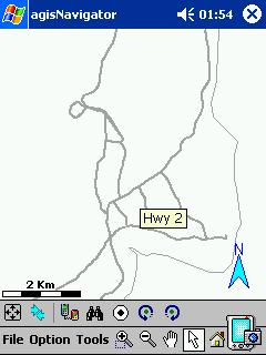
agisNavigator 1.1with map of Malaysia
(AsiaGIS)
GPS-enabled Navigational Software for PPC
Price: SGD499
Review item courtesy of agisNavigator authorised dealer for Malaysia
(weiminho@tm.net.my)
Product reviewed on ViewSonic VSMW25410 with Pocket PC 2002
For the past few years, local navigation enthusiasts tend to rely on the application Mapopolis (available for both PalmOS & PPC) and the free maps of local cities from Virtual Malaysia, to navigate around Peninsula Malaysia. Despite the various shortcomings of the free maps, they were quite popular since they were free and were the only ones available.
“Like tide, time waits for no man, nor beast” as the old saying goes. The same applies for software applications such as Mapopolis. With the progress of time, the application has evolved as new version of the software, with more features. As of last year, Mapopolis released new versions of their applications for both PPC (v.4) and PalmOS (renamed as Mapopolis Navigator). Unfortunately the free maps from Virtual Malaysia are currently incompatible with these new versions of Mapopolis. Therefore these local enthusiasts have to continue using these maps on the old versions of the software i.e. v5.19 for PalmOS and v3 for PPC. For those using newer PDAs such as the Treo 600 and Garmin iQue, they cannot run the old version of Mapopolis properly, therefore they cannot use the local maps from Virtual Malaysia.
For those with the necessary funds, they can buy navigation-capable GPS receivers such as the eTrex Vista/Legend and upload the necessary local maps from http://groups.msn.com/GPSMapMalaysiaSingapore into the GPS. For the rest of us navigation enthusiasts, who wants to utilise our PDAs for navigation purposes, the future seems bleak indeed.
agisNavigator with map of Malaysia is a navigational software and with the use of a GPS receiver, it will be able to show you the real time location of where you are. It is a comprehensive street level GPS-enabled maps covering highways of Peninsula Malaysia with detailed streets of Johor Bahru, Kuala Lumpur and Penang.
With the release of agisNavigator 1.1 by AsiaGIS, PPC-based navigation enthusiasts have a reason to celebrate. Now they have a commercial alternative to Mapopolis-based maps. PalmX would like to thank weiminho@tm.net.my, the local distributor, for allowing us to review the above application. Currently it is only available for PPC users, not for PalmOS PDAs.
Installation
The product consists of a single CD-R with a well-printed label. There was no manual included. Using such a CD-R will allow the company to upgrade the software at little cost since there wont be any need to trash the CDs of the previous version. However using a stick-on label will cause the CD-R to warp if it is kept in the CDROM drive too long, due to the increase in temperature. This happened to me when I got stumped by the installation procedure!
The content of the CD-R consisted of only a single file;
- agisNavigator1.1.exe (4,261KB)
Maybe they should have utilised the extra space by putting in the manual in Adobe Acrobat format (*.pdf). Since such a manual is not available, I have to rely on the help file installed in the PPC (File > Help > agisNavigator).
For the installation to work, the computer or notebook utilised for the installation should be connected to the Internet, during the installation. Otherwise you’ll be like me, wondering what went wrong for more than an hour ;-).
- Load the supplied CD-R into the CDROM drive of the computer/notebook.
- Use Windows Explorer to navigate to the CD.
- Execute the agisNavigator1.1.exe file.
- Follow the on-screen instructions.
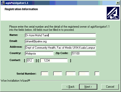 |
This is the reason why you need the Internet connection. Without it, you wont get this screen. This is to ensure that only the registered owner of the software can install the application onto their PPC.
Fill in all the details. The serial number should be on the envelope that came with the CD-R. Once done, click on “Next”. |
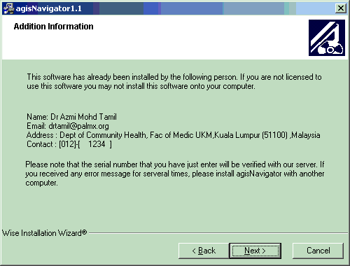 |
This is the next screen that you will get. Just click on “Next” and ignore their spelling mistakes ;-). |
 |
Just click on “Next” again. |
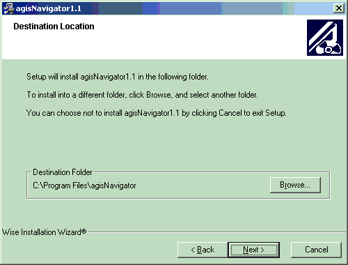 |
Do the same again unless you want it installed elsewhere. |
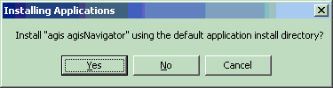 |
As usual, click on “Yes”. |
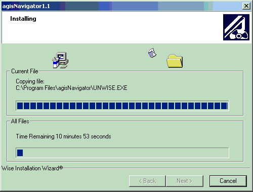 |
Please stay by your computer. You can’t go for your usual coffee break while the software is being installed 😉
You will get multiple prompts which you will need to respond to, for all the overlays or maps to be installed. Once done, the application and the maps/overlays will be installed into your PDA at the next “ActiveSync”. |
Features Overview
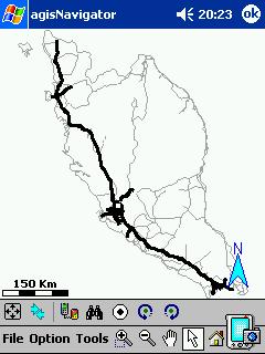 |
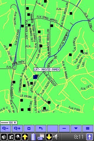
As stated earlier, agisNavigator with map of Malaysia, is a comprehensive street level GPS-enabled maps covering highways of Peninsula Malaysia with detailed streets of Johor Bahru, Kuala Lumpur and Penang. As we can see here, it does cover the highways of Peninsula Malaysia. Later on, you will see that it does have detailed streets of Johor Bahru, Kuala Lumpur and Penang.
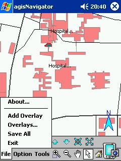
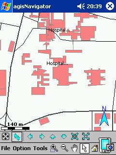
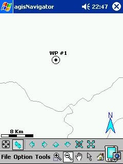
The screenshot here is what you will see when you start up the program. It is also known as the “Home” screen. Below it is the toolbar and the menubar. On the toolbar, you can see the Fullscreen option, Expanded toolbar, Connect to GPS, Find, Waypoint and Map rotation buttons. On the menubar is the File, Option, Tools, Zoom In, Zoom Out and Home button. You can learn how to use the toolbar and menubar by using Help. (File > Help > agisNavigator) If you’re not seeing anything at all on the screen, don’t worry. Just follow the steps stated below to display the maps; |
 |
|
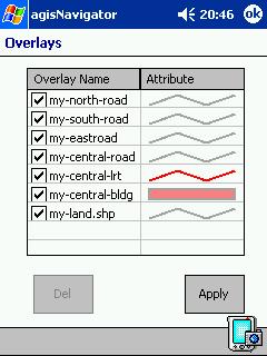 |
You may want to differentiate the different overlays by selecting a different colour for it. For example; changing the LRT overlay so that it red in colour instead of gray.
|
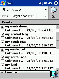 |
Take note of the size of the overlays. You may want to delete some of the overlays that you’re not going to use on a regular basis or shift them to your external memory card, if memory is an issue on your PDA. |
 |
This is what you’ll see when you click on the “Expanded Toolbar” button, a different set of toolbar for navigation. |
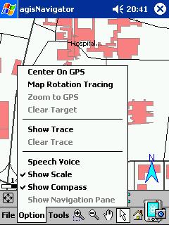 |
Under the “Option” menu, you have more options as illustrated on the left. These options will be touched in more depth in the next part of the review. |
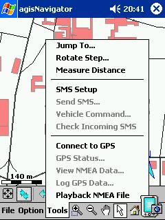 |
Under “Tools”, there are more options that you can select. These will also be covered in more depth in the next part of the review. |
agisNavigator vs Mapopolis Part 1
As pointed out in the introduction, agisNavigator is a potential replacement for Mapopolis & Virtual Malaysia’s free maps of local cities (from now on referred to as VM Mapopolis Maps) . Therefore it would be prudent to compare these two applications and their respective maps against each other. In this review, we will compare the coverage of local cities. For GPS navigation capabilities, we will cover that in the next part.
| agisNavigator | Mapopolis | Comparison |
|---|---|---|
 |
 |
I had my first chance to try out both of these software two weeks ago when I had to send my niece Aliya to her new school in Temerloh. Well that was what I thought when I saw the name “Sekolah Berasrama Penuh Berintegrasi Temerloh”. Turns out that the name was a misnomer since Temerloh was almost 20 km away! It was really in Kerdau, a small town which lies along the the road to Jerantut. Needless to say I got lost, despite the use of a GPS receiver, 2 GPS-enabled navigation softwares and the usual road map. The road from Mentakab to Temerloh was undergoing massive reconstruction and the road sign pointing to Jerantut at the junction was taken down. Since the road and the respective junction was not listed on both navigation software, I missed it totally and ended up on the road towards Maran. I ended up asking for directions from two Petronas stations and they pointed me to the right direction. Clearly the major trunk roads were missing from both maps. This is not acceptable. Even the free maps from http://groups.msn.com/GPSMapMalaysiaSingapore has most of the major trunk roads.
Verdict: VM Mapopolis Maps 0, agisNavigator 0. |
 |
 |
When I came back to Kuala Lumpur, I tried these softwares again. Both were equally good especially in the town centre. It was when I go to the suburbs that mistakes start to creep in. Most of the new townships were missing from both maps but agisNavigator seems to be more up-to-date.
Since agisNavigator includes buildings in the Klang Valley, I could search for individual buildings and navigate towards them. The VM Mapopolis map displays the road names automatically. In agisNavigator, I have to select the respective road just to see the road name. Not an easy task to do in a moving vehicle……. More about the navigation issues in the next article. Since the issue here is on coverage, the verdict is as follows; Verdict: VM Mapopolis Maps 1, agisNavigator 1. |
 |
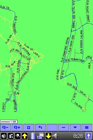 |
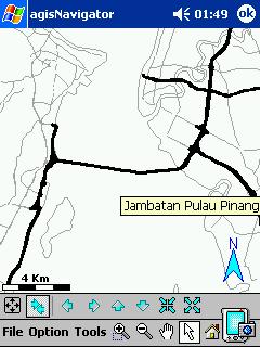
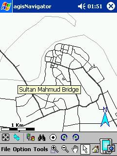
I wont be going in Penang in the near future but I wont let that stop me from comparing these two maps. The same issues that affected the above, also affected these maps.
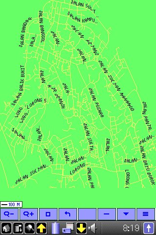
But I have to give the point to agisNavigator since the level of details was fantastic! Superficially they look the same, but once you start zooming in, you’ll realise that agisNavigator was far superior. Including the bridge was a huge plus point for agisNavigator. Seberang Prai was better covered by agisNavigator. Verdict: VM Mapopolis Maps 0, agisNavigator 1. |
 |
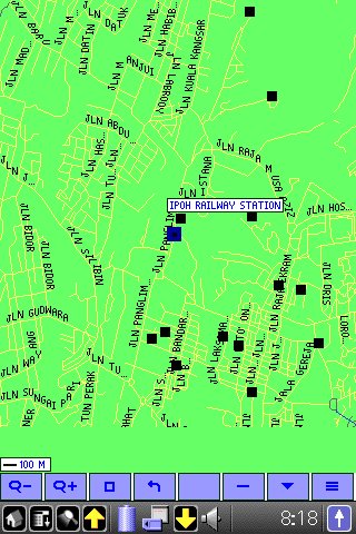 |
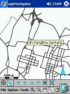
Surprisingly Ipoh was not well covered by agisNavigator. The major streets were there but it was not as detailed as the Penang and Kuala Lumpur maps.
VM Mapopolis map of Ipoh was more detailed but the major roads were not differentiated from the minor roads, making it very hard to comprehend. Both were equally poor but the VM Mapopolis map wins in terms of coverage. Verdict: VM Mapopolis Maps 1, agisNavigator 0. |
 |
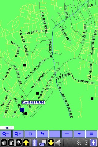 |
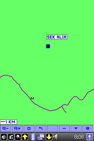
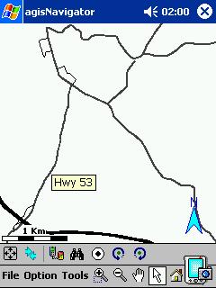
Kuantan was very poorly covered by agisNavigator, unlike VM Mapopolis. Just compare the two screenshots on the left and you’ll see what I meant.
Yes. I did zoom in on the agisNavigator map of Kuantan but nothing else was there. Verdict: VM Mapopolis Maps 1, agisNavigator 0. |
 |
 |
The Kuala Terengganu map was surprisingly better than Kuantan for agisNavigator. Better than Ipoh but not as detailed as Penang and Kuala Lumpur. Must be petrol dollars at work here 😉
VM Mapopolis map of Kuala Terengganu was more detailed but the major roads were not differentiated from the minor roads, making it very hard to comprehend. Verdict: VM Mapopolis Maps 1, agisNavigator 1. |
 |
 |
Seremban
Need I say more? 🙂 Same issues as the Kuantan map. Verdict: VM Mapopolis Maps 1, agisNavigator 0. |
 |
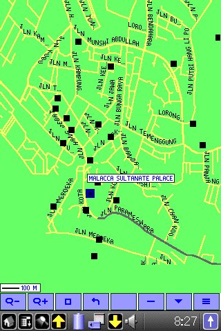 |
You guys have to take my word for it, VM Mapopolis map of Malacca is way better than agisNavigator. The screenshot for agisNavigator shows all the detail that was there. VM Mapopolis map of Malacca covers a lot more than just that.
Verdict: VM Mapopolis Maps 1, agisNavigator 0. |
 |
 |
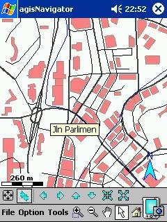
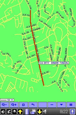
Current VM Mapopolis map of Johor Bahru is a far better version than the original one.
But I have to give the point to agisNavigator since the level of details was fantastic! Superficially they look the same, but once you start zooming in, you’ll realise that agisNavigator is far superior. Yes, I got lost a lot of times in Johor Bahru, but with agisNavigator at my side, that wont happen again, period! Verdict: VM Mapopolis Maps 0, agisNavigator 1. |
Conclusion
agisNavigator is a potential replacement for Mapopolis and VM Mapopolis maps. With a lot of improvements and better quality maps, it may even be an invaluable tool in everybody’s vehicle. Of course if they have a version for PalmOS, it would be even better! I can’t hide the fact that the price may be prohibitively expensive for the casual PDA user. Perhaps the Malaysian distributor has a better pricing system for us Malaysian :-).