agisNavigator 1.1with map of Malaysia
(AsiaGIS)
GPS-enabled Navigational Software for PPC
Price: SGD499
Review item courtesy of agisNavigator authorised dealer for Malaysia
(weiminho@tm.net.my)
Product reviewed on ViewSonic VSMW25410 with Pocket PC 2002
“The proof of the pudding is in the eating”. For a navigation software such as agisNavigator, the proof of its usefulness would be its ability in aiding GPS navigation. We will touch on that in this second part of two part review. The first part of of the review can be read here.
GPS Connectivity
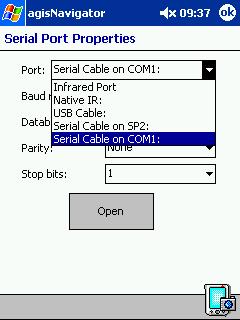
As expected of a navigation software, agisNavigator supports connection to GPS receivers that output in NMEA format. It connects via;
- IR
- Native IR
- USB
- Serial cable on SP2
- Serial cable on COM1
I can’t check for BT connectivity support since my PPC do not have BT capability.
If the appropriate COM port i.e. COM1 is not available, backup the contents of your PPC and do a hard reset. Then restore the data and run the application again. The COM port should be there now, if the port is present in the PPC. This happened to me this week, when COM1 went missing from my list of choices for GPS connection. Initially I thought it was due to software error, but it turns out that it was hardware error. I wasted a lot of time troubleshooting this problem since it was not discussed anywhere in the help file.
For this review, my PPC was connected to my eTrex GPS receiver, via its serial/cradle port using a customised cable. Such cables are available from PC-Mobile.
 |
Once the two items were connected to each other, click on “Tools > Connect to GPS” and select the appropriate “Serial Port Properties”. Then click on the “Open” button.
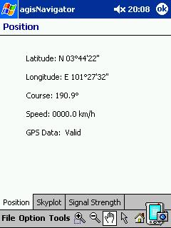
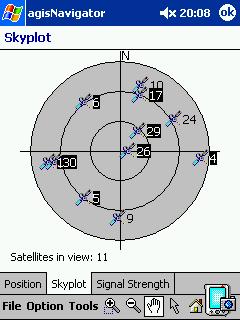
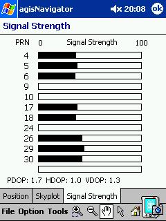
The two items will communicate with each other and your position coordinates will be displayed (these were the coordinates of a petrol station in Kuala Selangor). You can click on the “Skyplot” tab to see from which GPS satellites that you are receiving the signals from. You can check the signal strength by clicking on the “Signal Strength” tab. |
 |
 |
Navigation In General
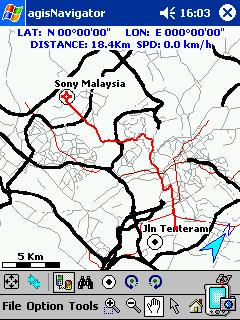
One of the sore points of navigation was the issue of accuracy. Due to the limitations of the consumer level GPS receivers, the accuracy of the position reported tend to vary between 7m till up to 54m or more! Usually the accuracy was around 8m, with a good fix from the GPS satellites. Therefore even if the GPS-enabled map was accurate, you may not be placed correctly on the map due to the inaccuracy of the position reported. Although you were travelling on the road, the map may have placed you travelling parallel to the road. Therefore it surprised me to read commentssuch as “more accurate compare with Mappopolis (that’s mean mostly u r driving on the road rather than out of the road)” (sic) about agisNavigator. After using it for about a month already, I see that it was almost true. I believe that it was done by getting the software to place the position of the user to the nearest road running parallel to the current position. I dare say this since a couple of times I noted that it placed my position on the wrong road, which was also parallel to my current position! Nice trick!
 |
agisNavigator also allows tracking of your movement from one place to another, similar to Handmap. You can also record it and play it back later.
You can measure the direct distance between two points. If you happen to know the coordinates of your destination, you can put it in via “Tools > Jump to…” and then jump to it or create a waypoint. But as stated in the first part of this review, agisNavigator doesn’t automatically display the name of the roads in the visible map. You need to tap on the respective object after tapping on the arrow icon, to see its name. |
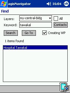 |
It also has an excellent search function. By selecting the appropriate overlay, you can search by the name of the road or building. You can also search for the location using the information from Contacts but I couldn’t get it to work. It kept crashing when I click on the “Contacts” button. |
Navigation via Targeting
The strong point of agisNavigator was supposed to be its ability of helping the user to navigate to his/her destination. Let’s just say that I was not impressed. Here was my own experience in using it. I was in HUKM Cheras and I wanted to get to Sony Malaysia in Tanjung Utama in Damansara to pick up my NX80V/G which was sent for repairs.
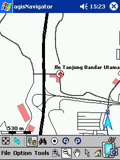 |
First I had to identify my destination on the software. Then I designate it as my target by pressing my stylus on it. On the pop-up menu, I selected “Set As Target” |
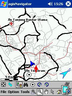 |
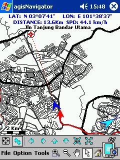
As I was driving towards my destination, a red dotted line points me towards my destination. Surprisingly the map automatically zooms out to accomodate both my current position and my destination. It refused to stay zoom in so that I can see the individual road. Sheesh! |
 |
As you head closer, then it began to zoom in. |
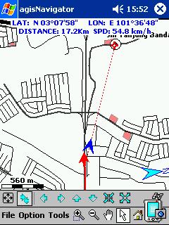 |
You get to see the individual roads only when you get closer. What’s the point?
There was no voice prompt to guide me nor was the route highlighted for me. So? Later I talked to by phone and he said that these were not yet available. Instead he suggested that I use waypoints to guide me to the destination. So that was what I tried next. |
Navigation via Waypoint
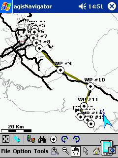 |
Since I had to drive down to Regency Hotel in Port Dickson, I decided to follow his advice and navigate using waypoints. I painstakingly identified all the critical junctions and turns and designated the necessary waypoints. |
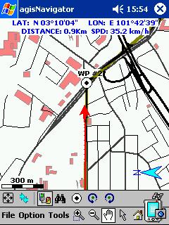 |
Later I just followed the gray line towards my destination. A workable solution but nothing to shout about.
It also ended on a sour note since the map didn’t include the new extension of the PD Highway. At the end of the new highway, I ended up turning the wrong way and was halfway to Linggi before I noticed the mistake 😛 |
Conclusion
The conclusion is still similar to the first part of the review. agisNavigator is a potential replacement for Mapopolis and VM Mapopolis maps. With a lot of improvements and better quality maps, it may even be an invaluable tool in everybody’s vehicle. Of course if they have a version for PalmOS, it would be even better! I can’t hide the fact that the price may be prohibitively expensive for the casual PDA user. Perhaps the Malaysian distributor has a better pricing system for us Malaysian 🙂
